|
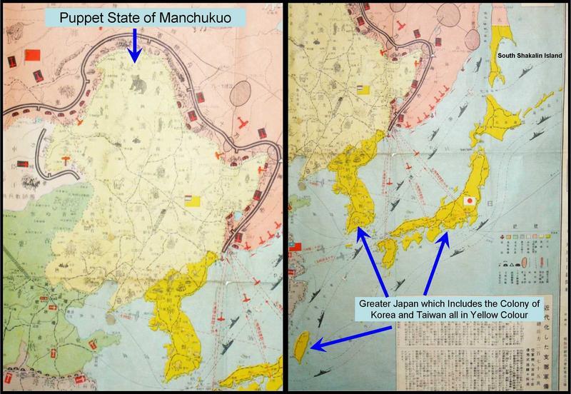
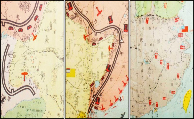
This is a Japanese military map of North Asia dated 25th/29th July, 12 Year of Showa reign. This is translated to the 12th year of Emperor Hirohito’s reign. He became emperor in 1926 and died in 1989. Add the 12 year to 1926 that translate the map dating to 1938. This is a general Japanese military map of North Asia of the Japanese troop deployment and the armies that they are fighting against. The countries shaded in dark yellow colour are greater Japan, which consist of Japan, the southern part of Shakalin Island (which is now part of Russia). It also includes Korean and Taiwan. The pink colour shading on the north and north-east is the then Soviet Russia or USSR. The light yellow colour shading is the puppet state of Manchukuo or Manchuria, which is the homeland of the Qing dynasty. This state in China is under the control of the Japanese imperial army. To the west is Mongolia which is shaded light grey in colour. To the south of Manchukuo state is the green colour zone, which is the buffer war zone of the Northern warlords and the Chung Hwa Ming Kuo or Nationalist government led by Chiang Kai Shek to the south (grey in colour). This is a very detailed general military deployment from all combatants which includes bunkers, troops, amours, ports, airfields, minefields, railway-lines and shipping lane. Also included are oil fields and produces of some of the region that are under the Japanese control
There are two main tears shown in picture 6 and minor folding tears/ holes aside from the folding lines. Otherwise, it is generally in good condition.
The measurement of the map: Length 77cm and the Height is 53.7cm.
Please refer to our stock # JA60021001 when inquiring.
Asian Antiques
Asian Decorative Arts
|